Mississippi System Interface
Evaluate source-region hydrology, flood-relief timing, water availability, navigation interactions, downstream effects, and legal constraints before any conveyance assumption is treated as credible.
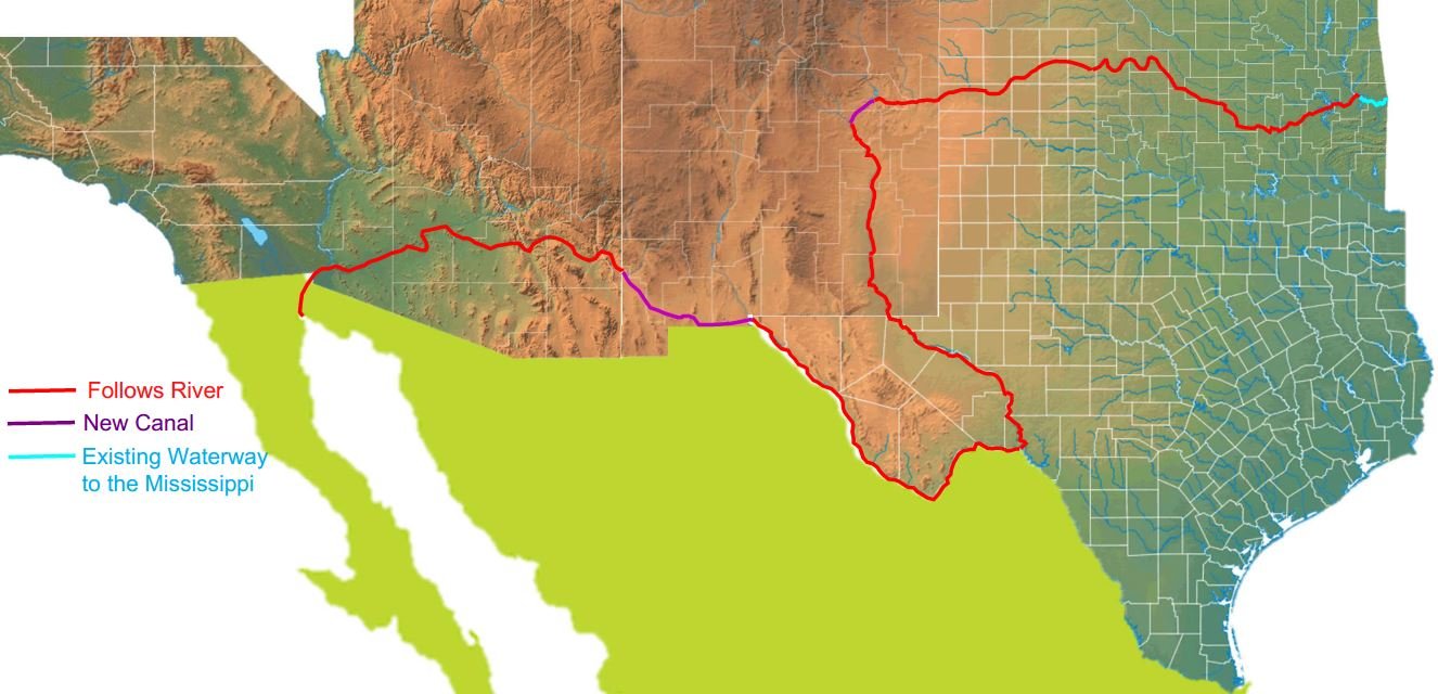
Route and maps
A proposed study alignment for evaluating a national-scale water, energy, and logistics corridor from the Mississippi River system toward the Gulf of California.
The northern route frames a serious feasibility pathway: screen the alignment, model water balance, define elevation strategy, establish environmental baselines, and build the cost ranges that can support investor-grade decisions.
The northern route concept shows how existing waterways, new conveyance sections, lift systems, reservoirs, logistics corridors, and environmental review zones could combine into a single American infrastructure platform.
The northern corridor brings together water source logic, elevation strategy, storage, transportation, power, land use, permitting, and regional growth in a sequence investors and partners can evaluate step by step.
Evaluate source-region hydrology, flood-relief timing, water availability, navigation interactions, downstream effects, and legal constraints before any conveyance assumption is treated as credible.
Study how existing river systems, reservoirs, new canal sections, pumping, locks, and controlled storage could work as an integrated water-management platform.
Identify elevation challenges, lift requirements, energy demand, geotechnical constraints, evaporation exposure, agricultural interfaces, and environmental review priorities.
Review destination-region hydrology, salinity, sediment, habitat effects, permitting questions, international considerations, and long-term operating scenarios.
Each reviewed assumption strengthens the investment pathway, turning corridor vision into staged decisions around water balance, elevation, environmental accountability, logistics, energy, and capital planning.
Next step
The northern route can advance as a disciplined infrastructure pathway: transparent assumptions, environmental accountability, staged capital, and a clear role for serious partners.